

Beginner’s Gold
A Guide to your First Multi-Day Bike Trip on the Clutha Gold Trail
So, you’re thinking about planning your first multi-day bike trip? Chapeau!
There’s no better place to dip your toe (or pedal!) into the world of cycle touring than the Clutha Gold Trail.
This trail is the ideal introduction to cycle holidays - gentle, scenic, scattered with historic towns, gorgeous riverside views, cafes for morning coffee stops and opportunities for a cheeky afternoon beer or pinot.
What is the Clutha Gold Trail?
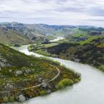
The Clutha Gold Trail is part of the Ngā Haerenga Great Rides of New Zealand network and stretches from Roxburgh Dam in Central Otago’s Teviot Valley, to Waihola on the east coast of the Clutha District. The trail is 135km long and comprised of a wide, well-formed gravel surface with a few gentle undulations. Rated a grade 2 (easy) trail it’s ideal for beginners and those tackling their first multi-day ride.
The trail is usually ridden over 3-4 days at a leisurely pace, with bike tour companies offering bike hire (including e-Bikes) and daily baggage transfers to your next night’s accommodation meaning you only need carry a small daypack with you.
Riders can start at any point along the trail and do as much or as little as they like. It’s a popular option for half-day or day rides, especially for families and active retirees who may not have ridden a bike for a while. There are seven trail towns (villages, really) along the way which offer accommodation for cyclists and warm hospitality at local cafes or pubs.
The Clutha Gold Trail is the perfect choice for your first multi-day ride.
It stretches for 135km from Lake Roxburgh Village in Central Otago to Waihola in Clutha District.
What's in a name?
During the Otago Gold Rush (which started in 1861 at Gabriel’s Gully, just off the trail in Lawrence), the Clutha River | Mata Au and its tributaries were heavily mined for alluvial gold. The river was colloquially referred to by miners as “the golden river,” due to the richness of its gold deposits.
Hence, the Clutha Gold Trail is named after both the Clutha River, which the trail follows for about 50km between Roxburgh Dam and Beaumont, and it also celebrates the river’s heritage as that “golden river” of the 1860’s as well as the wider goldmining history of the region.
The trail owes its name to the mighty Clutha River | Mata Au and the region's rich goldmining heritage.
Why the Clutha Gold Trails is Great for First-Timers
Mostly flat or gently undulating and no traffic
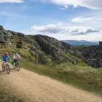
The easy (grade 2) trail is on well-formed gravel paths, with trail towns regularly spaced along the way for coffee and lunch stops. The trail is off-road, meaning no traffic, although it does cross main road from time to time, so care needs to be taken.
It’s only 135km long
OK, so this might sound initially daunting, but broken into 3-4 days the distances are totally doable, especially with a wee boost from a e-Bike and with regular stops along the way for snacks and sightseeing.
Easy logistics
One of the best things about the Clutha Gold is how easy it is to organise your trip. You’ll be as good as gold, thanks to local bike tour companies who’ve got all the bases covered. These experienced operators will take care of everything you can possibly think of, plus some stuff you probably haven’t even thought of yet! Accommodation, bike hire (including e-Bikes), transfers and often bookings for evening meals are all included in the deal.
8 Benefits of Booking with a Bike Tour Company
Natural shade – ideal for summer riding
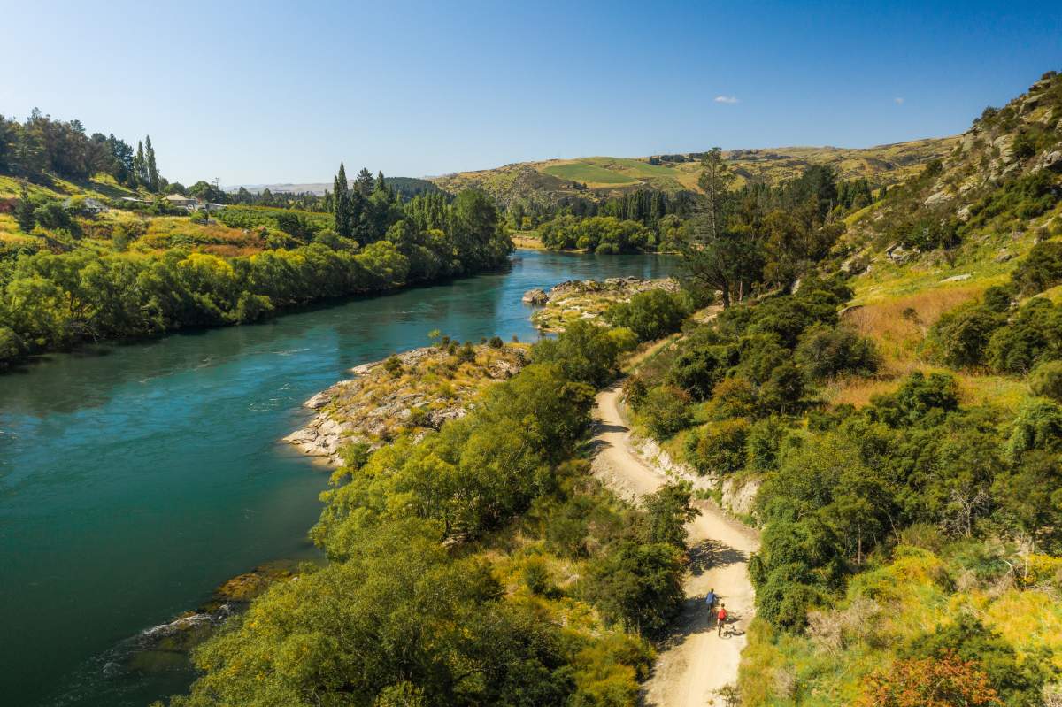
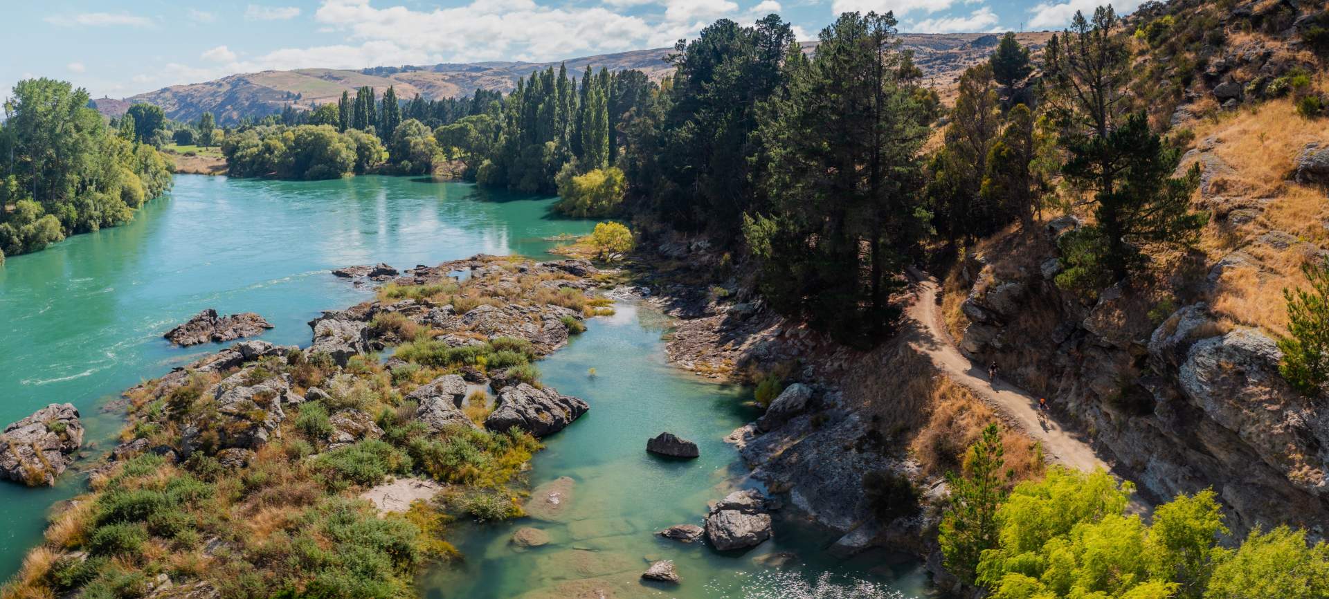
The Clutha Gold Trail follows the tree-lined Clutha River for over 50km, offering not only beautiful views of the river and surrounding countryside, but cool, shady riding which can be a welcome relief on hot Central Otago days. Once you leave the river behind at Beaumont, the trail continues to offer regular wooded sections out of the full sun.
Wind avoidance
The trail is more sheltered than some of the other Great Rides, especially along the riverbanks and through wooded areas - which can make for a calmer, more pleasant ride for new cyclists with less chance of having to battle into a head wind.
Off the beaten track... but not too remote
The Clutha Gold Trail is generally less busy than some of the more well-known Great Rides, which means a more peaceful and personal experience - ideal for first-timers looking to ease into bike-touring.
Variety and ever changing scenery
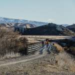
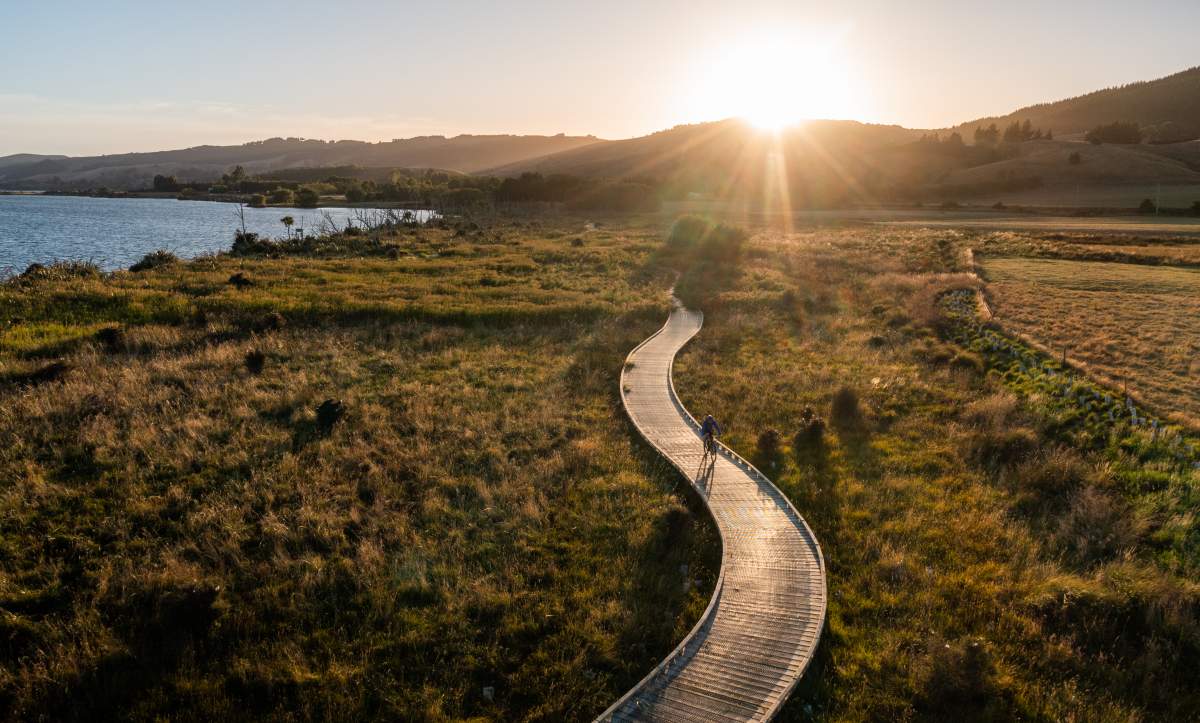
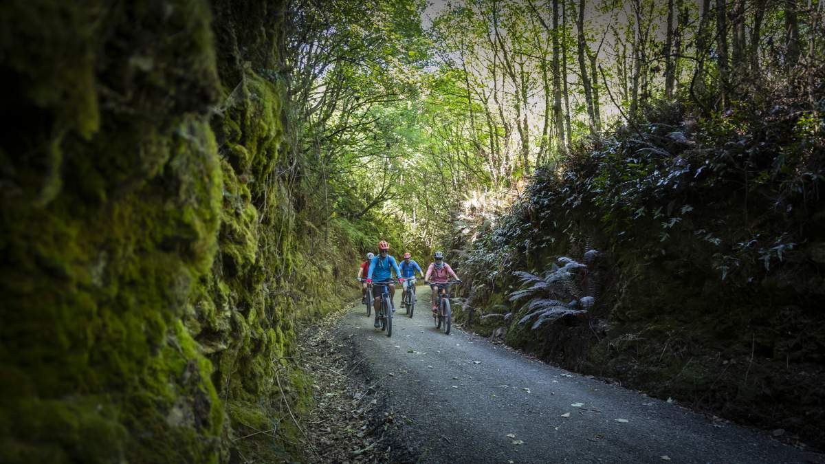
The Clutha Gold includes shaded gorges, tunnels, farmland, native bush, lakeside boardwalks through wetlands, riverside riding and gold mining heritage sites. You still get the tunnels, historic bridges, and the charm of gold mining towns made famous on other Great Rides, but there’s also a scenic change as you transition from Central Otago towards coastal Otago.

Visit the official Clutha Gold Trail website, where you’ll find trail maps, route descriptions, up to date trail information and listings for official trail partners including bike hire, tour operators and accommodation.
The Clutha NZ and Central Otago NZ websites are also useful resources.
An Easy Itinerary for First Timers
Roxburgh to Waihola is the more common direction of travel along the trail, with most of the bigger bike tour operators servicing the Clutha Gold Trail from hubs in Alexandra, Cromwell or Clyde. But there’s no real advantage or disadvantage to riding the trail in either direction.
Here’s an easily achievable itinerary for your first trip, but if you’re booking via a tour company, they can help plan your schedule and can customise it to suit your timeframe, budget and riding ability.
Not quite ready for a full four-day ride? No problem. Half-day and full-day rides are popular too with bike hire and return transfer options available.
Day 1: Roxburgh Dam to Millers Flat (29km)
Highlights: Riding across the impressive Roxburgh Dam, gorgeous river views, lunch in Roxburgh with fresh fruit from the orchards of the Teviot Valley or a visit to the world-famous-in-NZ Jimmys Pies. Not far from Roxburgh, Pinders Pond is a great spot for a picnic with safe swimming.
Day 2: Millers Flat to Lawrence (44km)
Highlights: a detour to visit the Horseshoe Bend Bridge and Lonely Graves, bring a head torch for Big Hill Tunnel, and don’t miss Gabriel’s Gully just outside Lawrence – the site where gold was initially discovered in 1861.
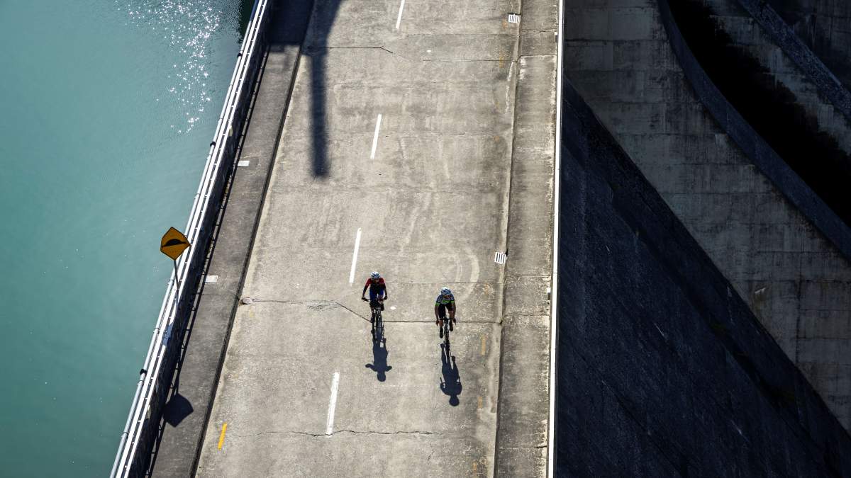
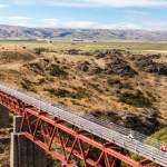
Crossing the Roxburgh Dam to the start of the trail at Commissioner's Flat

"Gateway to Jimmy's Pies"... the Roxburgh Bridge. Roxburgh is a perfect stop for morning tea or lunch.

Millers Flat - the tavern across the bridge is a great lunch or evening meal option.

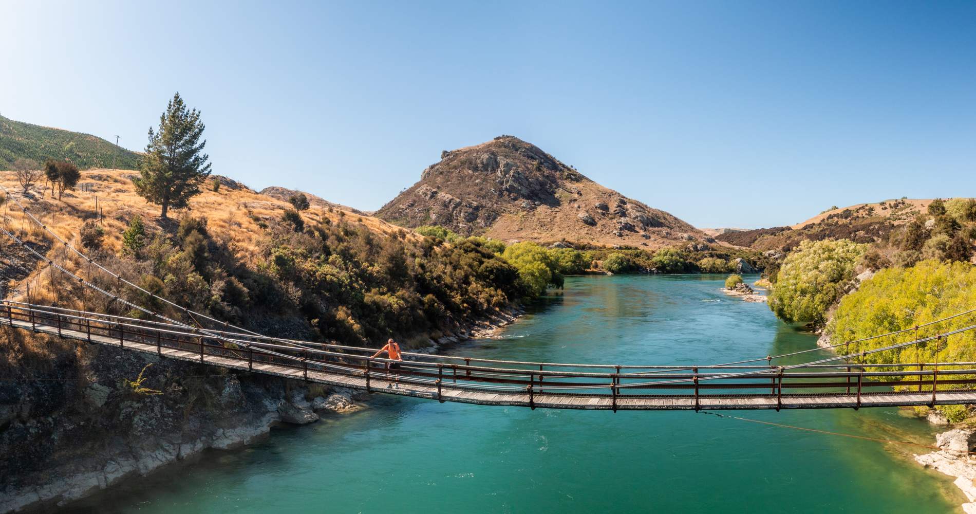
Horseshoe Bend Bridge is well worth the short diversion from the trail.
Day 3: Lawrence to Milton (45km)
Highlights: the beautifully renovated Waitahuna Station complete with coffee cart, two more tunnels at Round Hill and Mt Stuart, and the Mt Stuart Reserve is a scenic picnic area and idyllic place for an afternoon snooze under the trees.
Day 4: Milton to Waihola (17km)
Highlights: the funky Calder Stuart bridges, the impressive boardwalk sections around Lake Waihola and wetlands, and then celebratory fish and chips in Waihola to mark the completion of your first multi-day ride.
The tranquil trail town of Lawrence, a recommended overnight stop.
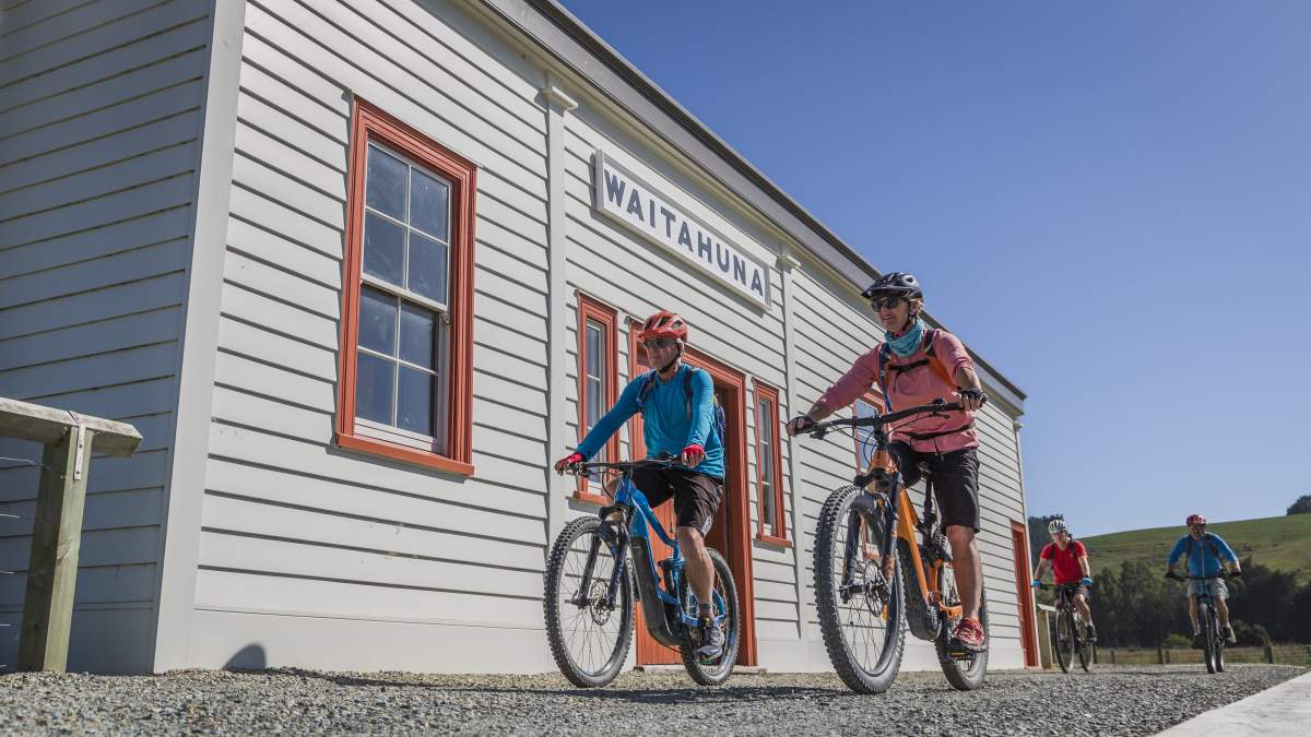
The lovingly restored Waitahuna Railway Station - also an essential coffee stop.
The trail follows the easy gradient of the old railway for some distance.
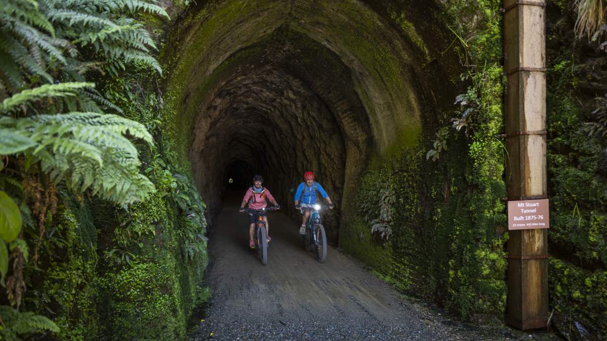
With three tunnels to explore along the way.
Staying Safe and Comfortable on the Trail
- Saddle comfort - yes, your butt might feel it to begin with, but it gets easier! Padded cycling shorts are a must and gel seat covers are readily available from bike hire companies.
- Staying hydrated – make sure you have enough water to get between each trail town, especially during the height of summer. A good supply of snacks is also a great idea.
- Mobile coverage – there is generally good cell phone coverage along the Clutha Gold Trail, but there are some patches where reception may drop out, particularly on more remote sections.
- Trail signage – it’s hard to get lost on the Clutha Gold Trail, as it has excellent signage and the trail is easy to follow.
- Trail etiquette – expect to share the trail with other cyclists and walkers, ring your bell when approaching other trail users or call out a friendly “good morning”. More on trail etiquette here.
- e-Bikes – “range anxiety” is a thing! In other words, worrying about your battery lasting the duration. However, this shouldn’t be an issue on the Clutha Gold Trail as most itineraries are well within the range of e-Bike batteries, but it pays to check where the next e-Bike charging location will be (usually at your accommodation each evening).
Check out our essential guide to e-Bikes. - Weather – always check the weather forecast before you depart, and consider delaying your trip if bad weather is expected. Slip, slap, slop in summer and always take an extra layer or two with you in case thee weather changes unexpectedly. Check the Central Otago regional forecast here, and Clutha District here.
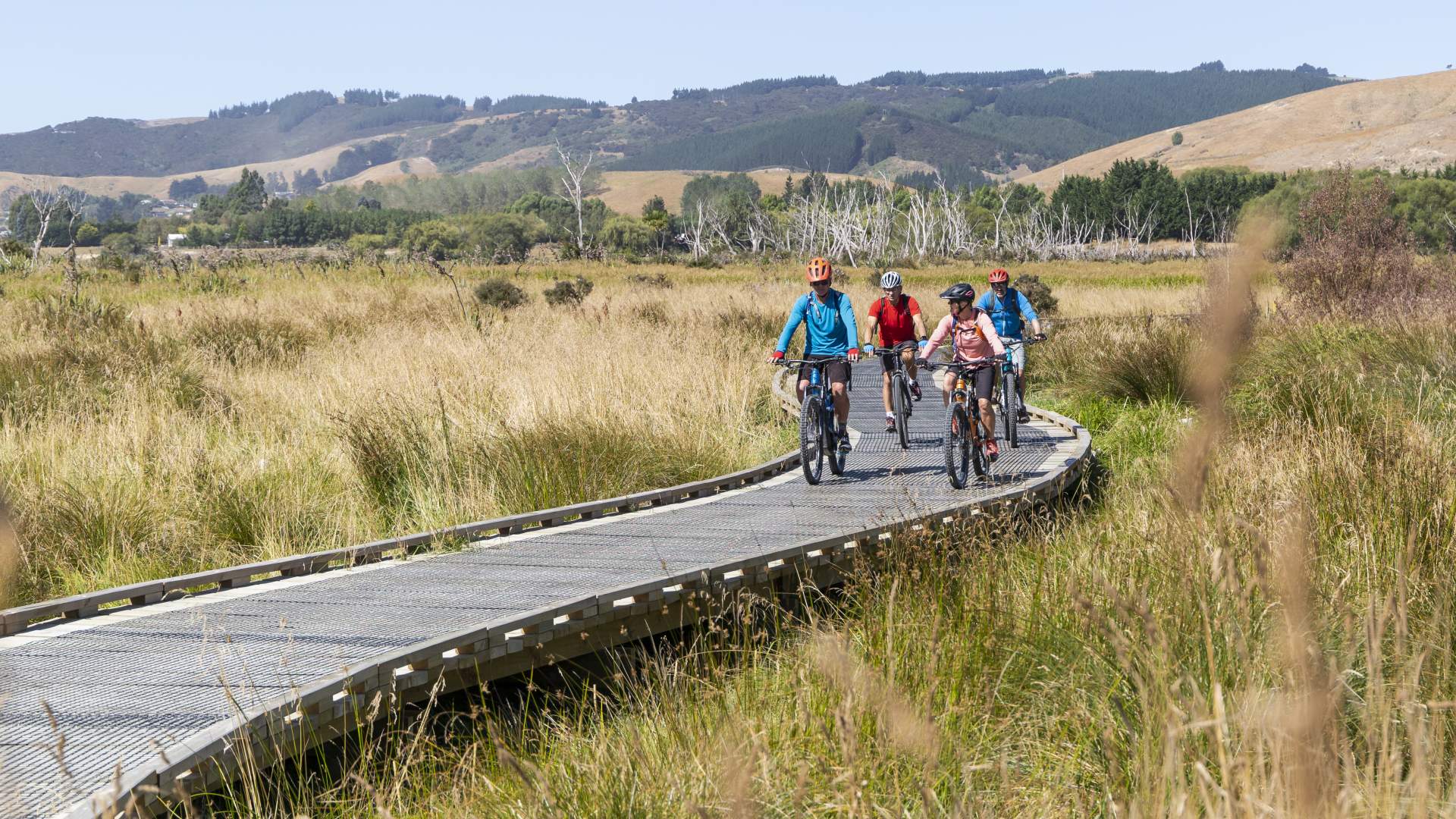
e-Bikes have made the Clutha Gold Trail accessible for a wider audience. Photo: Lake Waihola wetlands.
Clutha Gold Trail FAQs
Do I need to train?
Probably, just a wee bit, even if you’re only riding 30-40kms per day. Whilst e-Bikes assist you on your ride, they don’t do all the work, so a few training rides at home or on an exercise bike in the gym will help. Remember that e-Bikes don’t help with bike handling skills, and they can be heavy so if you have a chance to practice on an e-Bike before your trip that would be beneficial.
What should I pack for a multi-day ride?
If you book through a tour operator, chances are that you're baggage will be transferred for you each day to your next night's accommodation, so weight isn't really an issue - you'll just need a small daypack or panniers with room for water, snacks and a warm / wet weather layer. Here's a useful guide to help you pack, and if you're riding independently check on this beginner's guide to your first bikepacking adventure.
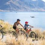
Is it family friendly?
Yes. Kids love the trail and it’s an ideal trail for a family ride. Of course, care needs to be taken around the river and when crossing the main roads.
Are there toilets on the trail?
Yes, toilets are available along the length of the trail but can often be quite a distance apart. It pays to check the map to plan to understand where the next toilets are available. You can download the Clutha Gold Trail map here.
When is the best time of year to ride?
The Clutha Gold Trail is open year-round but is best enjoyed between spring an autumn. With the right warm layers, winter riding can be rewarding, but its worth checking the opening times of cafes or pubs in winter as some businesses may be closed or operate reduced hours.
What are the local food highlights along the way?
- Fresh fruit from the orchards of the Teviot Valley in Roxburgh, coffee and cake from 103 The Store, and of course Jimmy's Pies!
- Millers Flat Tavern for wholesome pub grub.
- Coffee and cheese rolls at The Prospector café in Lawrence.
- Coffee and a scone just when you need from the Waitahuna coffee cart.
- Fish and Chips in Waihola is a Clutha Gold Trail must do!
How to get here
- Queenstown Airport is 1h 30mins from the start of the trail in Lake Roxburgh village, and Dunedin Airport is just 15minutes from the Waihola end of the trail.
- Shuttle transfers from bike tour operators will take you from your accommodation to the start of the trail, and operators can recommend safe places to leave your car whilst on the trail. Some operators offer airport pickups too.
- The Clutha Gold Trail is located along State Highway 8 between Dunedin and Alexandra with many safe access points along the trail for self-drive itineraries. See map for details.
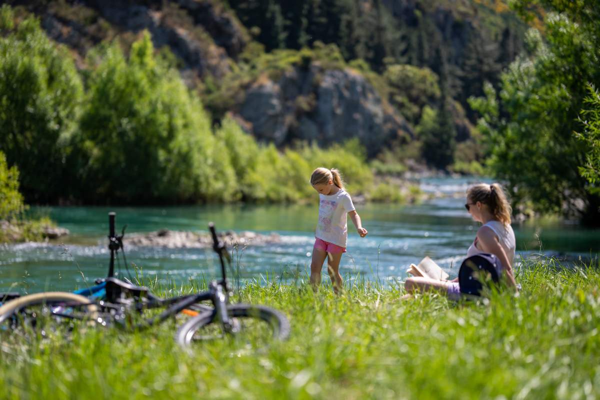
The Clutha Gold Trail is perfect for family rides and picnics [Photo: James Hustler].
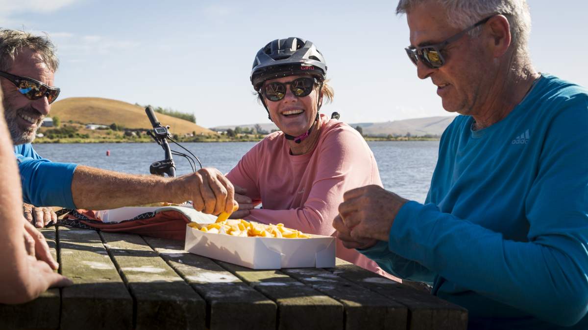
Fish and chips in Waihola to celebrate the completion of your first multi-day ride is a must!
You've struck gold!
The Clutha Gold Trail is pure cycling gold for beginners. It’s scenic, stress-free, and offers just the right amount of challenge to make you feel proud without needing a post-holiday chiropractor.
So, book that trip, and discover how much fun multi-day biking can be. The hardest part of the ride might just be deciding which trail to ride next?...
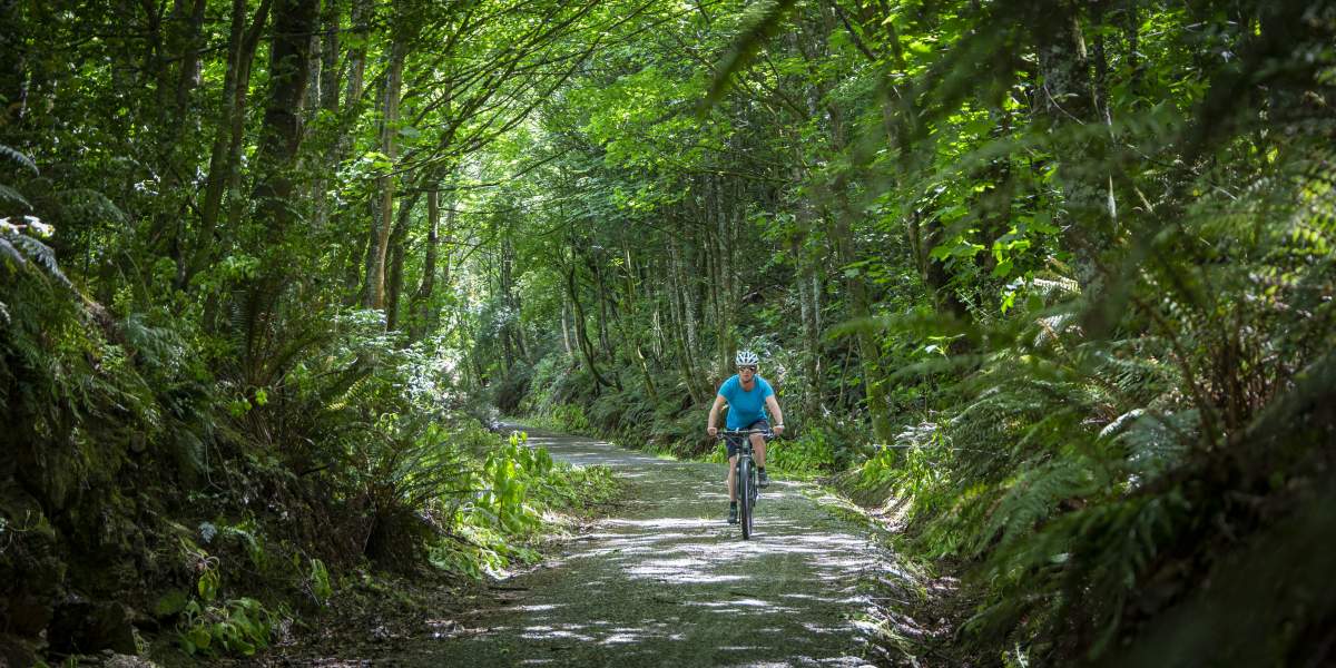
The Clutha Gold Trail traverses varied landscapes from woodland...
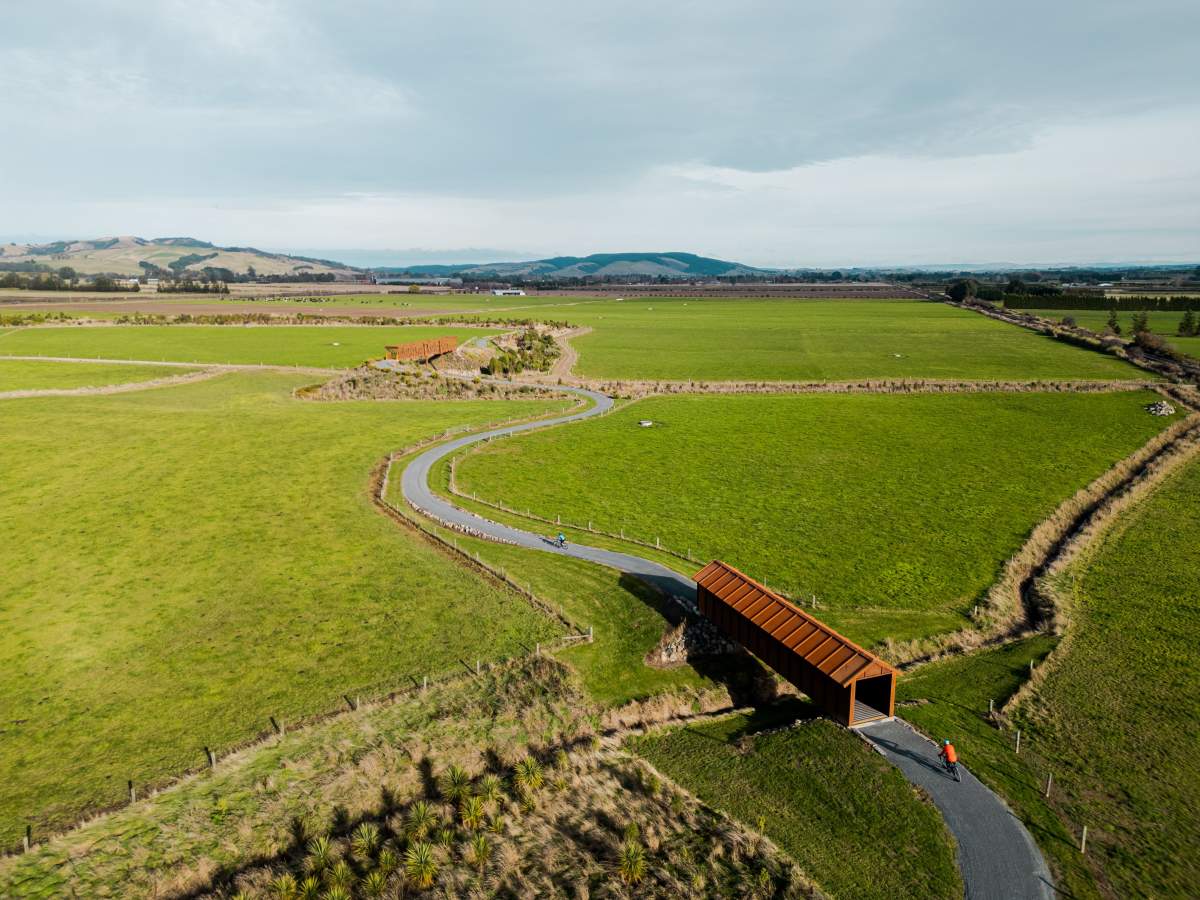
...to the expansive Taieri Plains of coastal Otago.

Related Stories
-

Otago’s Greatest Hits
Highlights of the Clutha Gold and Roxburgh Gorge Trails
Read more about Otago’s Greatest Hits -
One Day Winter Wonders
The best bike rides on the Otago cycle trails in winter.
Read more about One Day Winter Wonders -
11 of the Best Short Walks in Otago
11 of the best short walks in Otago and close to the cycle trails, ranging from 30 minutes up to 3 hours.
Read more about 11 of the Best Short Walks in Otago -
Otago's Signature Tracks
Best short rides on the Queenstown Trails
Read more about Otago's Signature Tracks -
Otago's Classic Hits
Highlights of the Otago Central Rail Trail and Lake Dunstan Trail
Read more about Otago's Classic Hits -
Otago Central Rail Trail Pub Guide
A guide to the pubs along the Otago Central Rail Trail
Read more about Otago Central Rail Trail Pub Guide -
Beginners Guide to Queenstown Trails
A beginner's guide to biking the Queenstown Trails
Read more about Beginners Guide to Queenstown Trails -
Beginners Guide to the Otago Central Rail Trail
A beginner's guide to the Otago Central Rail Trail
Read more about Beginners Guide to the Otago Central Rail Trail -
Don't just ride - play bike!
If we play sports, then why don't we "play bike"?
Read more about Don't just ride - play bike!