

Navigating Mapping Apps
A Beginner’s Guide to Bikepacking by Phone
You don’t need an expensive GPS bike computer to tackle your first overnight bikepacking trip. With a smartphone, a simple mapping app and a little preparation before you leave home, you can plan a suitable route and stay on track even when mobile coverage drops out.
11th November 2026
There is something wonderfully uncomplicated about simply riding a bike.
Route planning, however, can feel less straightforward. It’s one thing to be lost in your thoughts, and another to be lost on the trail!...
Do I need a Garmin? Which app shows gravel roads? Will my map keep working beyond the last patch of reception? And what exactly is a GPX file?
The good news is that your smart phone probably contains most of the technology you need for a multi-day bikepacking trip. Mapping apps can help you create a route, check elevation and surface, locate services en route and track your progress while riding.
No single app does everything perfectly. A sensible beginner setup is usually one primary app for planning and navigation, supported by an offline topographic map for when you head further into the backcountry or rural areas where the cell network may be less reliable.
A few mapping terms to know:
Before looking at the apps, it helps to understand four common terms:
- Route planning means creating or adapting the line you intend to ride.
- Navigation means following that route once you’re on the bike.
- Offline maps are stored on your phone, so they remain visible without mobile coverage.
- GPX is a common file format used to transfer a route between apps, websites and GPS devices.
Here’s a quick snapshot of some of the most popular mapping tools used in New Zealand and what they’re best for.
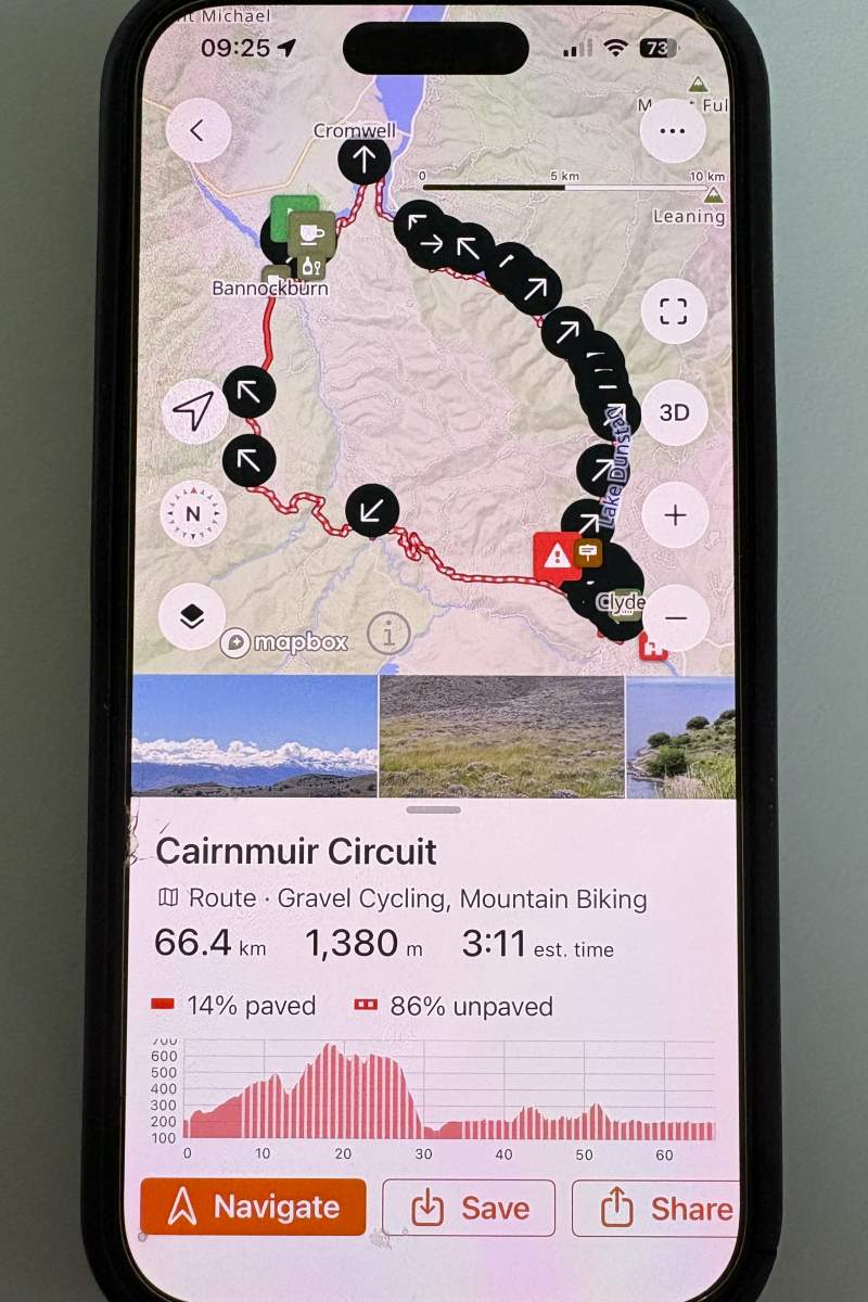
Ride with GPS provides detailed bikepacking route planning and turn-by-turn navigation.
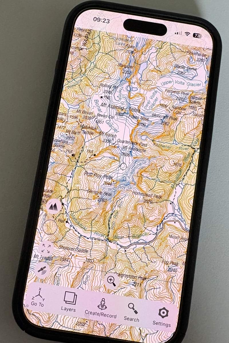
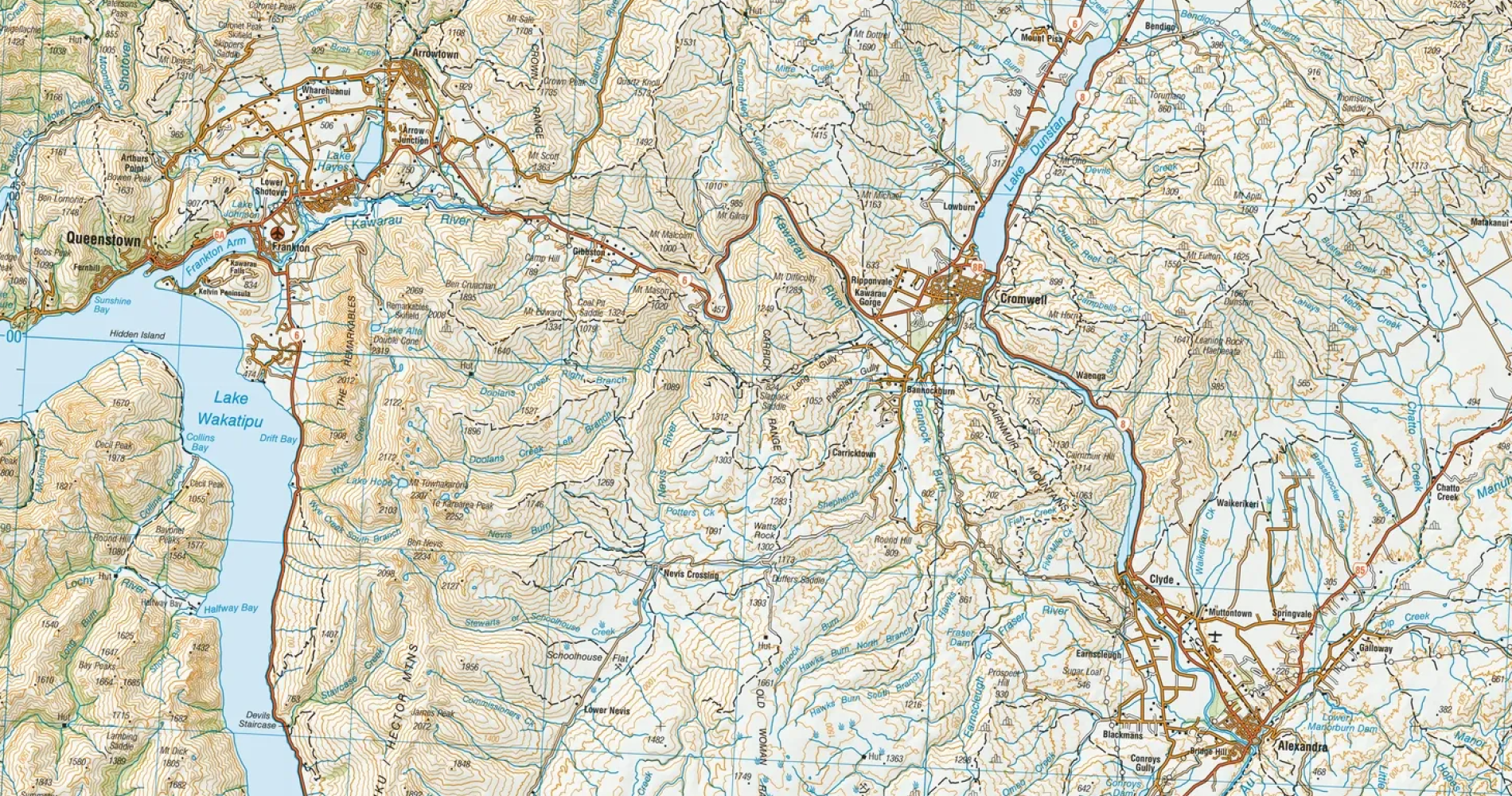
NZ Topo 50 is fully available offline and useful for backcountry navigation.
Strava
www.strava.com
Many cyclists already use Strava to record rides and keep up (or compete) with friends. Its mapping tools can also be useful during the early stages of planning, particularly its heatmaps, which show routes commonly used by other riders.
Routes recorded by other users can help identify likely cycling connections, although remember that a highlighted line is not a guarantee that it is publicly accessible or suitable for your bike. Subscribers can draw routes, explore suggested routes and save routes for offline use. Anyone can record an activity without mobile coverage, but downloading and following an offline route requires a subscription.
Best for: Finding popular cycling routes and seeing where other riders tend to go.
Ride with GPS
www.ridewithgps.com
Ride with GPS is one of the best all-round options for bikepacking and cycle touring. Its route planner lets you build a ride and inspect useful details such as elevation, surface information, points of interest and cycling heatmaps.
The desktop planner is particularly good when you want to fine-tune a route or move it away from an unsuitable section of road. On the bike, the phone app can provide visual and spoken turn-by-turn instructions, including alerts while the screen is locked. Maps and routes can also be downloaded before departure, although offline navigation requires a paid Basic or Premium subscription.
Best for: Detailed bikepacking route planning and turn-by-turn navigation.
NZTopo50
www.topomap.co.nz
For trips into more remote corners of Aotearoa, NZTopo50 makes a very useful companion. The app is based on the official 1:50,000 topographic maps produced from Toitū Te Whenua Land Information New Zealand (LINZ) data, showing contours, waterways, tracks and other landscape features.
The full map is stored on your phone, so it works without mobile coverage and does not require you to remember to download each individual area before a trip. You can see your GPS position, create waypoints, record your track and import GPX routes. It does use a reasonable amount of phone storage, but that is the trade-off for having detailed maps available anywhere in the country.
The app is available for iOS, Google or Android and with separate downloads for the North and South Island maps. It currently costs NZD $6.99 each for North and South Island maps.
Best for: Offline backcountry mapping and understanding the terrain surrounding your route.
Most mapping apps allow you to share and publish interactive versions of your routes, like the example gravel biking route below in Central Otago:
Google Maps
http://maps.google.com
Google Maps is best thought of as the practical trip-planning assistant in your pocket. It’s handy for locating cafés, supermarkets, accommodation, bike shops and other services. It can also give you a quick overview of the roads connecting two places.
Its cycling directions are useful through urban areas and on established roads, but Google Maps should not be your only navigation tool for a remote bikepacking ride. Although you can download a map area, Google advises that cycling and walking directions are unavailable offline. A suggested cycling route should also be checked against a cycling-specific app, topographic map and current local information before you commit to it.
Best for: Finding food, accommodation and services, and navigating around towns.
Trailforks
www.trailforks.com
If your trip includes a mountain bike park, purpose-built trail or section of singletrack, Trailforks can fill in details that general mapping apps often miss.
Its trail information can include difficulty, permitted activities, preferred direction, popularity, photos and reported conditions. You can change the activity setting to suit mountain biking, gravel riding or another outdoor pursuit, while its route planner can help piece together trails and access roads. Trail information and regions can also be downloaded for offline use.
Coverage varies between locations, and user-contributed information may not always reflect the latest closure or access change. Check official trail or landowner updates before setting off.
Best for: Checking mountain bike trails, trail networks and off-road connections.
Komoot
www.komoot.com
Komoot provides an approachable route planner for cycling, gravel riding, mountain biking trail running and hiking. Select the type of riding you intend to do, and it will suggest a route using activity-specific information.
Elevation and surface details help you judge whether a route suits your bike, available time and fitness. The app also offers turn-by-turn navigation, while planned routes can be saved for offline use. Komoot generally includes one region free, with additional regional or worldwide map access available as a purchase.
As with every automatically generated route, look closely before accepting its suggestion. A short line across the map could turn out to be steep singletrack, a rough farm road or somewhere bikes are not permitted.
Best for: Straightforward planning with helpful surface and elevation information.
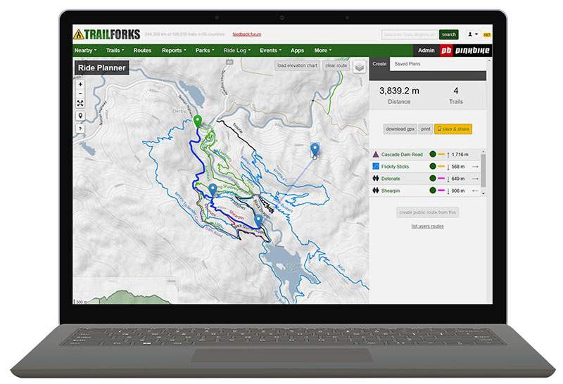
Trailforks is useful for checking mountain bike trails and track networks.
Before you roll out
Most importantly, test your setup. Put your phone into flight mode at home and confirm that you can still open the map, see the route and locate your position.
Before your ride, charge your phone fully and carry a power bank as a backup. Continuous GPS recording, a bright screen and cold conditions can all drain a battery surprisingly quickly. Keep the phone protected from rain and consider using audio directions rather than leaving the screen on all day.
Remember that a line on a map does not guarantee legal access or a rideable surface. Check the road or trail status, land access, river conditions and weather forecasts using official sources. It is also wise to save the route in a second app, take screenshots of important junctions and share your plans with someone at home.
Mapping apps take much of the guesswork out of bikepacking, but they work best when you have prepared before leaving home. Start with a manageable route, learn how your chosen app behaves offline and give yourself plenty of daylight. Once you’ve successfully planned and navigated your first overnighter, a much bigger map of possibilities begins to open up.

Related Stories
-

Spring Cycling For Beginners
Haven’t ridden over winter? Follow this easy six-week training guide and build up to a multi-day spring ride on one of Otago’s cycle trails.
Read more about Spring Cycling For Beginners -
E-Biking the Otago Trails What You Need to Know
New to E-biking or planning your first multi-day cycle holiday? Here’s what you need to know before exploring Otago’s Great Rides.
Read more about E-Biking the Otago Trails What You Need to Know -
Gravel Biking Otago
A guide to gravel biking in Otago - trail tips and routes.
Read more about Gravel Biking Otago -
Spring Bike Maintenance Checklist
Get your bicycle or E-Bike ready for spring with this practical maintenance checklist covering tyres, brakes, gears, chains and safety checks.
Read more about Spring Bike Maintenance Checklist